In Iceland, every landscape tells a story of geological drama, where geothermal activity interacts with ancient glaciology. It’s a land of contradictions and contrasts, where fire and ice intertwine in a mesmerizing dance. The result is a destination unlike any other where the forces of nature collide to create a spectacle that defies imagination. Join us on a journey through the “land of fire and ice.”
Fire: Exploring Iceland’s Volcanic Power
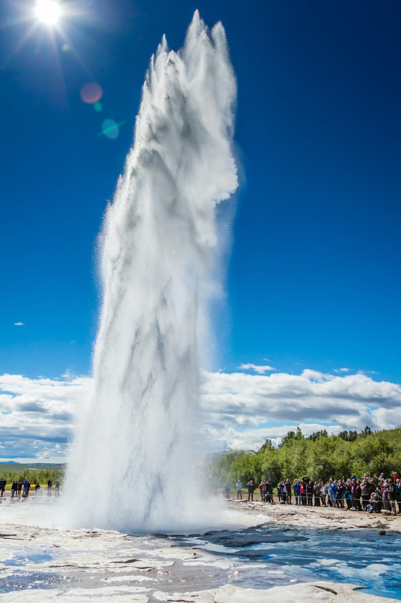
- The Mighty Geysers of Haukadalur: Geysers arise from the same forces that create hot springs, but are much rarer. They are formed by tube-like holes on the surface that run down deep into the Earth’s crust. When water is heated from geothermal activity and begins to boil, it turns to steam or gas that jets toward the surface. The result can be a rush of water shooting over 100 feet into the air. One of Iceland’s most famous (and reliable) is Strokkur, a geyser that erupts with remarkable regularity, shooting scalding water high into the air amidst a landscape of bubbling hot springs and steaming vents. It is an impressive and exciting reminder of the geothermal energy that helped create Iceland.
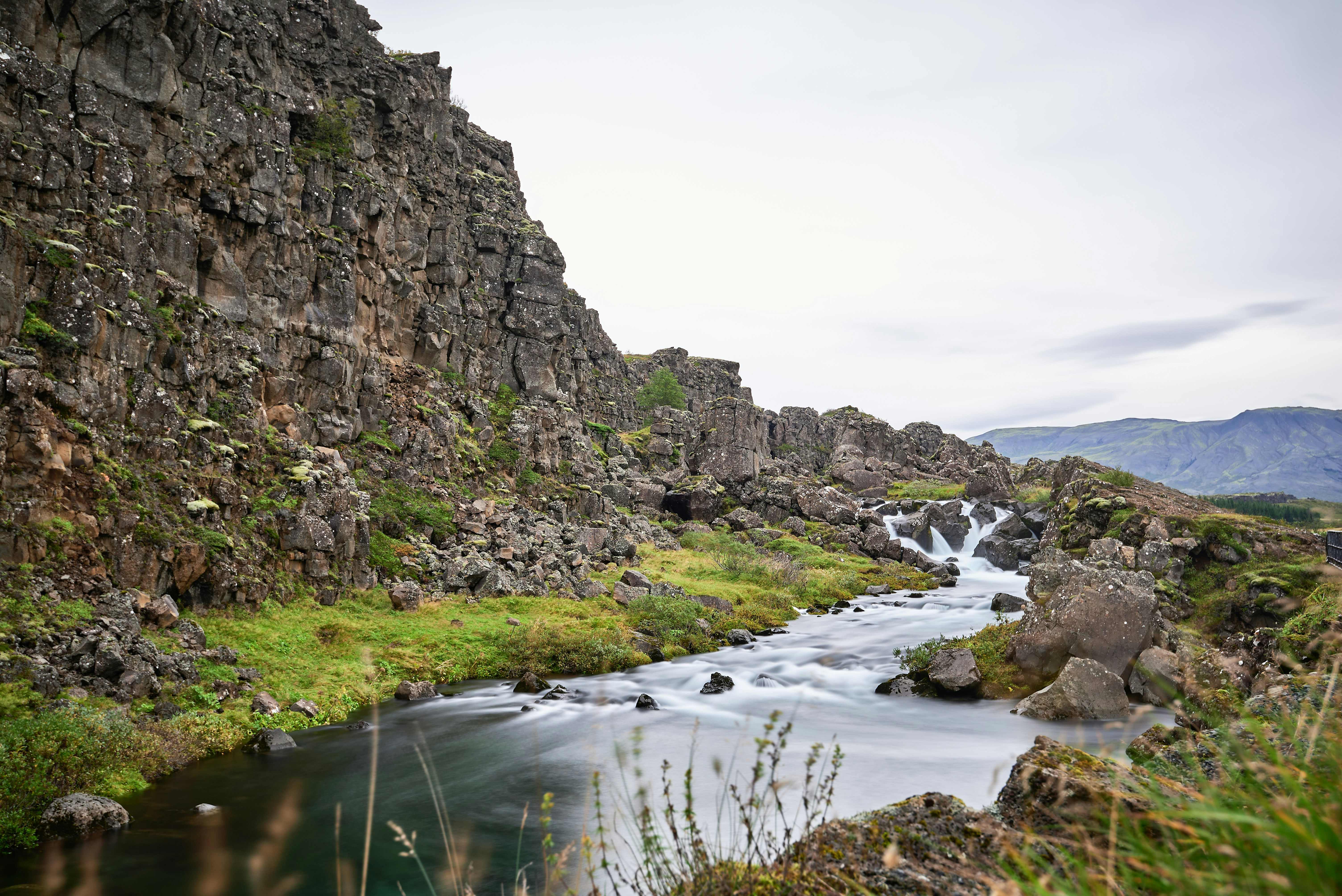
- The Fiery Heart of Þingvellir National Park: Iceland’s volcanic landscape the result of its location over two tectonic plates, the Eurasian and North American. It is one of the only places on land where you can stand between these continental giants in the dramatic rift valley of Þingvellir. It’s a site of towering cliffs, jagged fissures, and deep history: in ancient times, leaders would stand on the rock above the gorge and announce the first laws of Iceland.
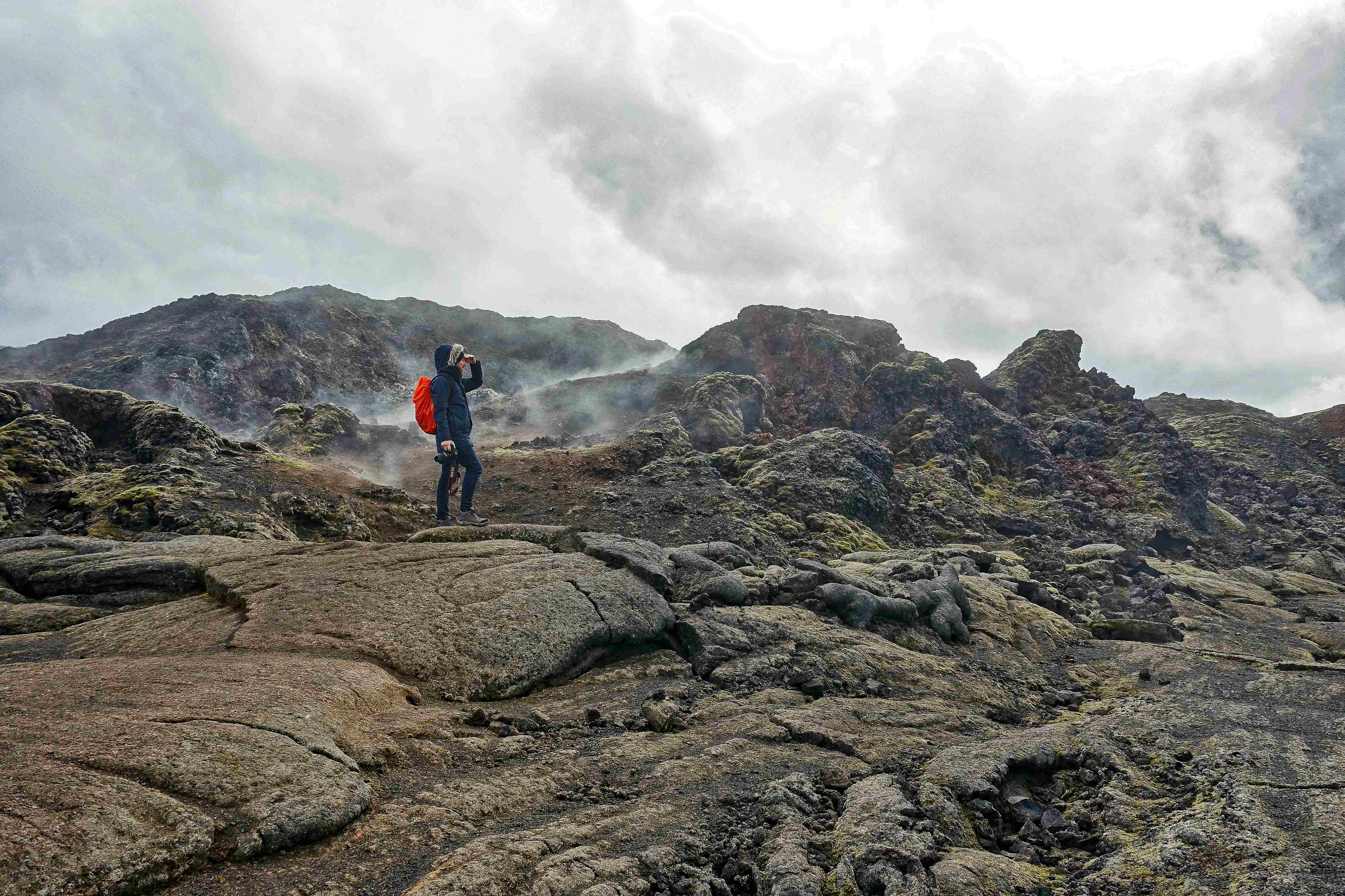
- The Volcanic Craters of Krafla: The terrain of Krafla is truly otherworldly. It is a volcanic caldera dotted with steaming vents, bubbling mud pools, and neon-colored mineral deposits. Trek across a lunar-like landscape shaped by centuries of volcanic activity, and witness the raw forces that continue to shape Iceland’s dynamic geology.
Ice: A Glacial Wonderland
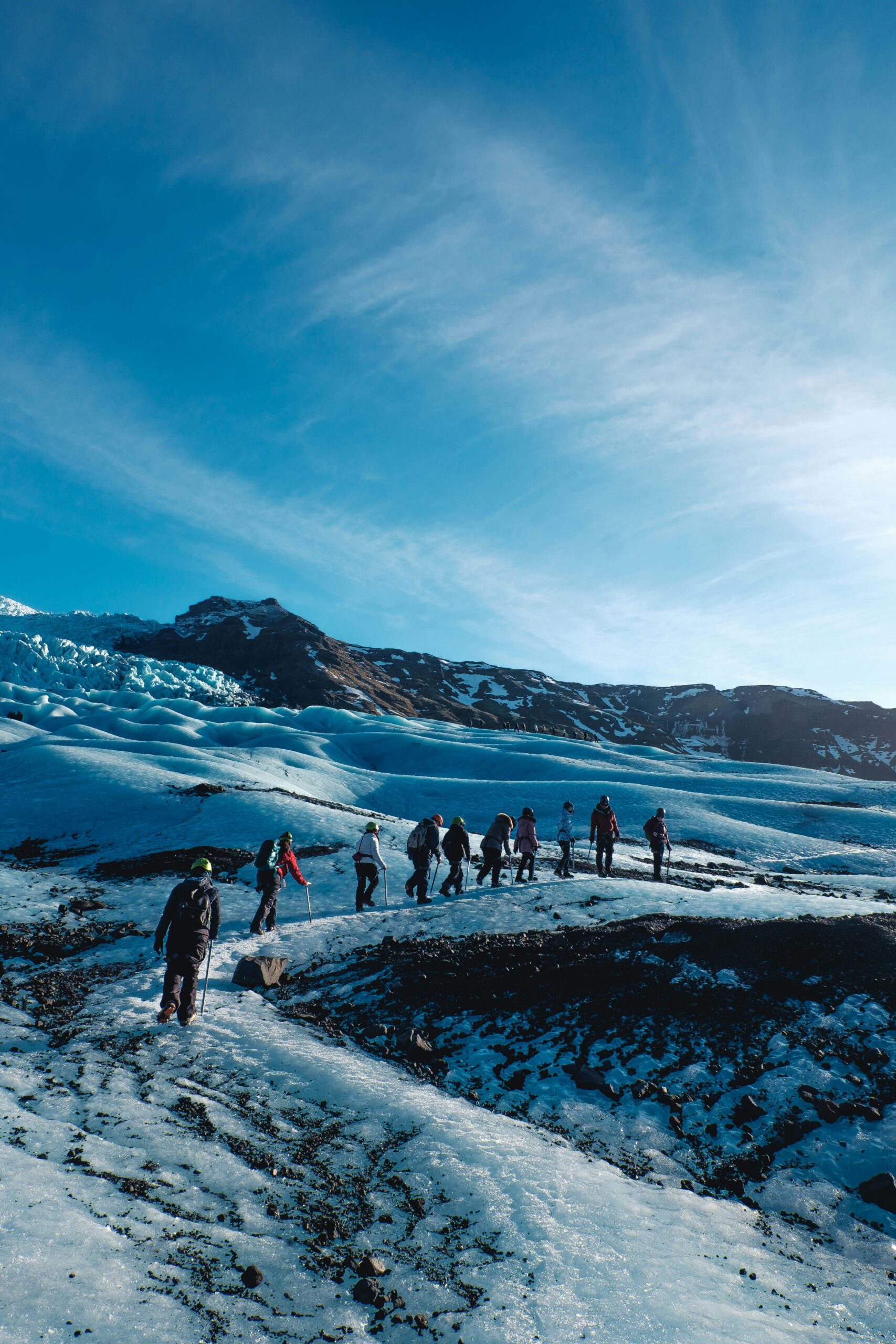
- The Glaciers of Vatnajökull National Park: Vatnajökull National Park was established in June 2008 and has slowly grown to include more area. The park now covers over 5,000 square miles, which is 14% of the country’s total area. It is the second-largest national park in Europe and one of three UNESCO World Heritage sites in Iceland. Within it, you will find the Vatnajökull glacier, the largest in Europe, covering eight percent of Iceland’s landmass. The park is a labyrinth of ice caves and towering ice formations carved over millennia, all of which provide ample opportunity for ice climbing and glacier trekking.
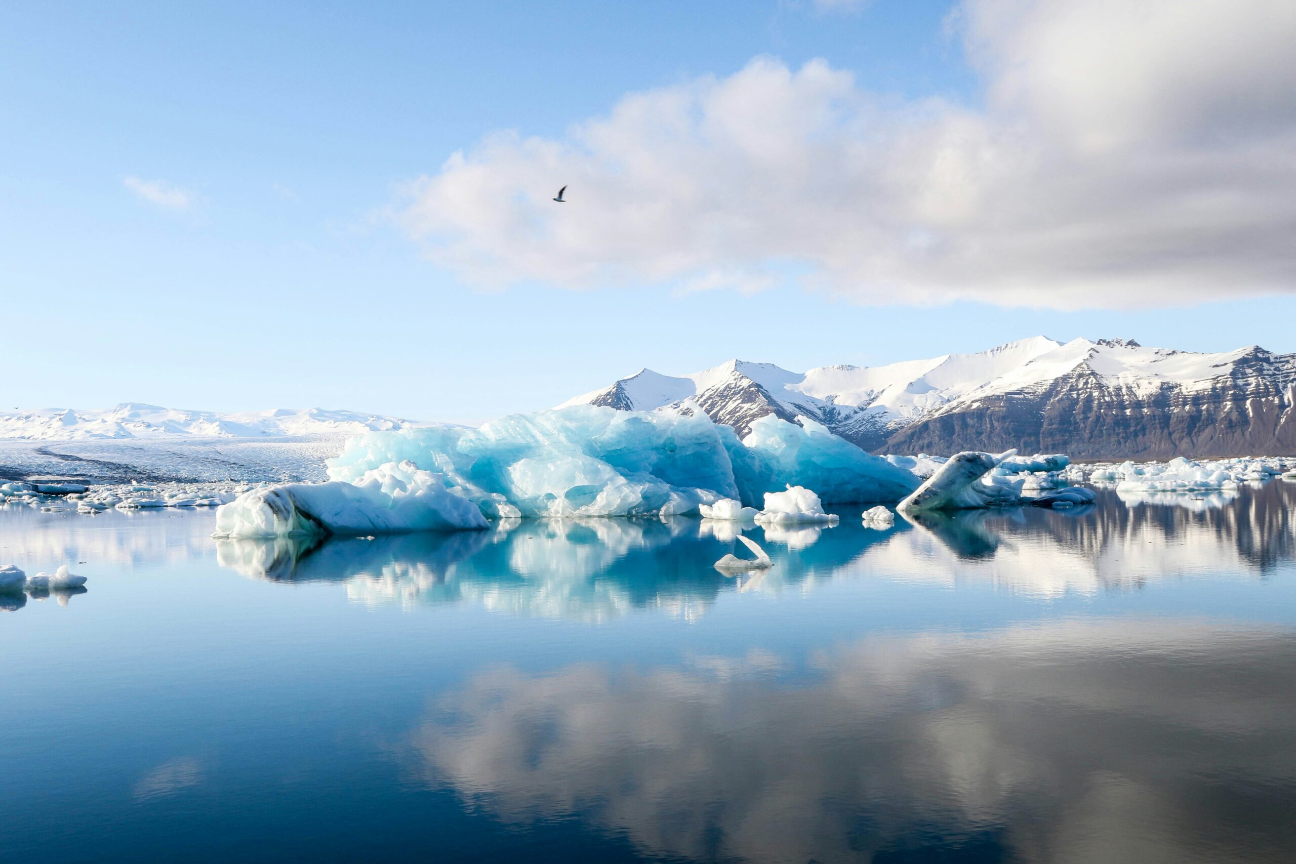
- The Sapphire Waters of Jökulsárlón Glacier Lagoon: One of Iceland’s most visited landmarks within Vatnajökull National Park is the Jökulsárlón glacier lagoon, which sits at the base of the outlet glacier Breidamerkurjokull. Here, large icebergs that have broken off the glacier float across a vast lake of meltwater before ending their journey in the Atlantic Ocean. The icebergs in their various states create a scene of ethereal beauty as they float on the crystalline waters. Kayak amidst these floating giants or capture the tranquility of the landscape with some of the most beautiful photo opportunities Iceland has to offer.
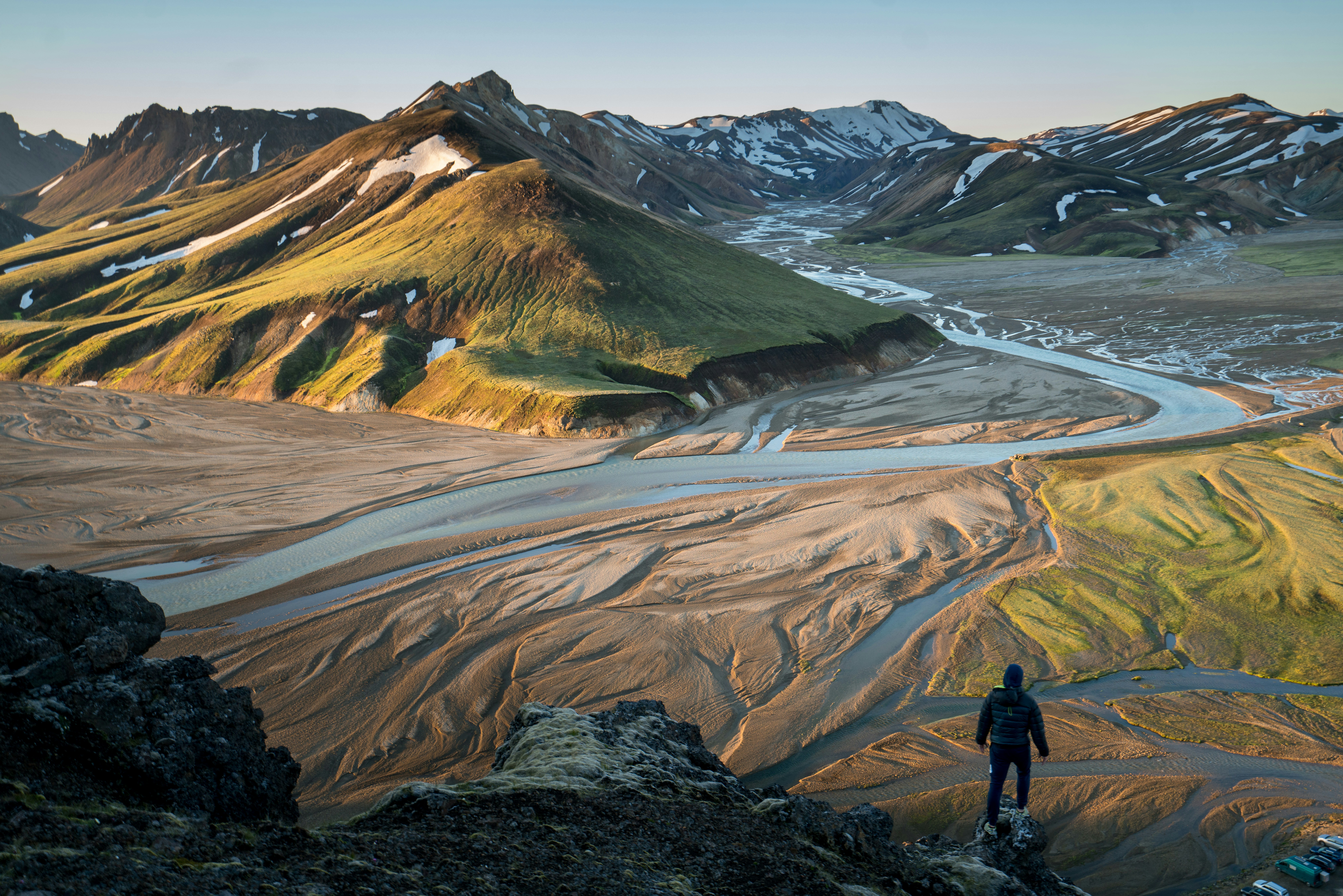
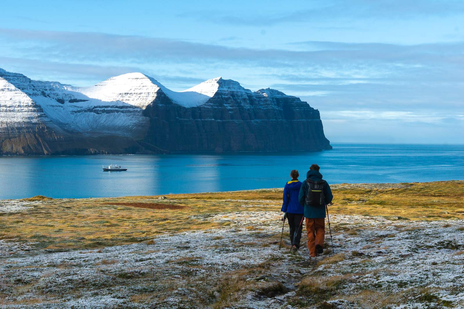
- The Arctic Highlands of Landmannalaugar: Landmannalaugar, or the “People’s Pools,” is a vast area of stunning and unique beauty in the heart of Iceland’s southern Highlands. Throughout the summer, it is one of the most popular places for hiking including the famous Laugavegur Trail. The area is characterized by colorful snow capped mountains formed from volcanic activity over millions of years. The striking hues of red, orange, yellow, and green are a result of the mineral-rich rhyolite rocks, which have been sculpted by glaciers and weathered by time.